Today’s journey was a short one- covering 3 prefectures, about 47 Km, and just over 4 hours (including breaks). Let’s look into my journey in a bit more detail.
As always my journey started in Nabari city- which is on the outskirts of Mie prefecture and located just 25 km from Kyoto Prefecture (or 京都府 in Japanese) and I decided it would be good idea to cycle there.
Just so you get the full picture, the bike I have was woefully terrible for such a journey. The bike is called a ママチャリ or mother’s bike. It has 6 gears, a basket on the front and is designed for inner city rides- not hills (which is everything in the Nabari and Iga areas) so the distance I covered was, in my opinion, miraculous.
Similar to my previous cycling post- the journey from Nabari to Mihata, I traveled to Komo following Nabari river- which as I found out is no-where near the most dangerous road in this area. Upon arrival in Komo, I turned left at the t-junction and cycled onward for quite a while.

The road between Nabari and Nara Prefecture (called the Nara-Nabari way/ line 奈良名張線), is a beautiful road. It snakes along Nabari river and up some steep hills (there were professional cyclists there who did pass me). I did have to walk up this rather large hill but it opened up to reveal a tiny village/ hamlet Takahira, Nara.
Imagine a place where nothing seems to happen and most people just know it by “the place you pass through”- this is Takahira. There are a few houses, many chickens, a shrine and not much else. But the views of Nabari river were spectacular.
I continued and I discovered, what I am calling “the road of death”. It is a tiny carriage way, with a massive drop into the river on one side, a steep cliff on the other (with signs warning you about the possibility of falling rocks) and many, many blind corners.

I worried for naught, no car came but it was awesome- speeding around tight bends on a bike, while enjoying nature all around me. After this section I came across a camp grounds with the best name you can imagine form Japan “hell ground skate-park” no name analysis needed here- but i did look pretty awesome and seemed to be extremely cheap!
Following the skate park from hell (no more puns I swear), I had a decision to make, up the mountain or down by the river? I chose the river and I descended the hill for 3-5 minutes (I may have burnt my breaks a bit descending safely). I arrived at Hirose (大字広瀬) which was bigger than the last village but not by much. The highlight for me was the bridge which allowed me to get this shot of the river:

In the top right of the picture is half of the hill I descended. This village is a boarder town between Nara and Mie Prefecture with the river (sort-of) acting like to boarder.
Moving on from Hirose, the roads (actual roads) seemed to be a repeating theme of my bike being the only vehicle on the road and it is here that I ran over a snake (I’m unsure if it was a snake or a branch or if it was alive before I ran it over).
It was at this point, that I stopped taking photos and focused on my destination to get to 三県境 or the 3 prefecture boarder. The problem with this, I seemed to forget how much Mie and Nara Prefectures love hills. I rode through hamlets, villages, back roads, main roads in isolation- completely enjoying myself and my journey.
The only problem I faced was near the end of part 1 on the outskirts of Shirakashi, Iga, on the Shimagahara way (島ヶ原線). This road was entirely uphill, up a very steep hill- too steep to ascend while cycling.

The ironic thing about this picture is that it was at the start of the descent back down but it opened up to what I will call the city of hawks.

Hawks are solitary by nature but there were so many here- along with either ravens or crows (the difference between is a matter of a pinion- sorry clever pun).
The problem with my destination was simple, there were no signs, no clear path- nothing to mark out where it lay. I cycled up and down a not inconsiderable hill for a while. Eventually I found where it was. Just opposite from the sign below is a small lay-by. From this point it is a hike to the 3 prefecture boarder. However, I has turned 1500 and as all roads taken were country roads, I had to leave to get back before nightfall- which was a disappointment.

The way back was slightly more enjoyable as I found my portable battery pack so my phone (and google maps) allowed me to find a good was back.
There were a few gems on my way back and now I had a charge, I could once again take photos- so I was extremely happy. But more importantly, I was able to see more of Nabari (Mihata, Kikyougaoka, and Nabari city)- which is exactly what I wanted to do.
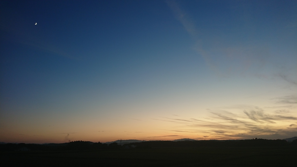
When I got back into Nabari, it was quickly going dark, and getting cold. Even though I am sad that I didn’t quite see what I set out to, I got to experience an awful lot and I got back safely.
The ironic thing about the length of time it took is that by car it is just a 50 minute return trip- cycling and walking did slow down this time- as well as getting repeatedly lost or doing in the wrong direction.
The victims of this cycle were the (possible) snake, my hands (i forgot my gloves) and my bike (which now skips while cycling). Perhaps the cheap bike designed for city living couldn’t handle a mountainous journey.
Thank you for reading and happy exploring.